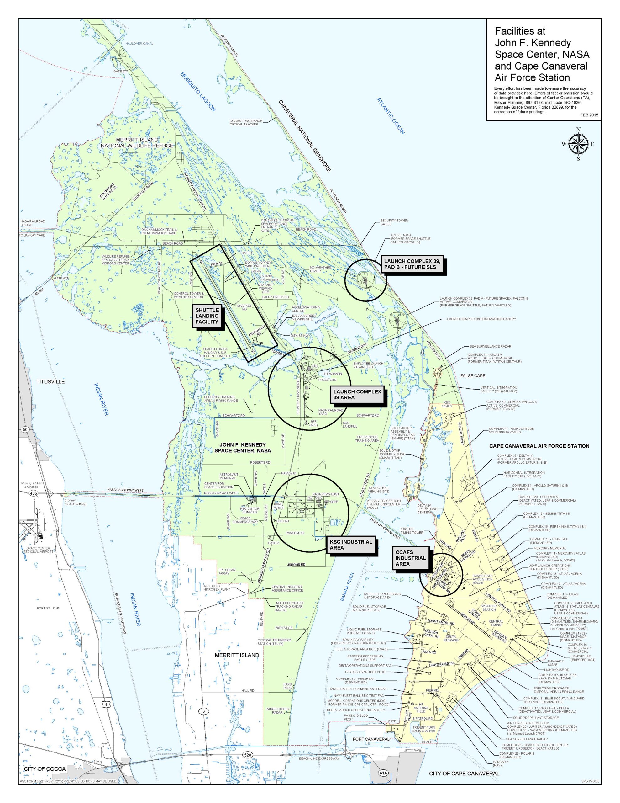

NASA Kennedy Space Center (KSC)
KSC (Kennedy Space Center) is one of 10 NASA field centers, is a premier multiuser spaceport with more than 90 private-sector partners and nearly 250 partnership agreements. Once known as Cape Kennedy, opened 1968. KSC is adjacent to Cape Canaveral Space Force Station (CCSFS). Location: Merritt Island, Florida.
Kennedy Space Center (KSC), Cape Canaveral, Port Canaveral, Merritt Island, Florida, FL, USA.
Status: Active
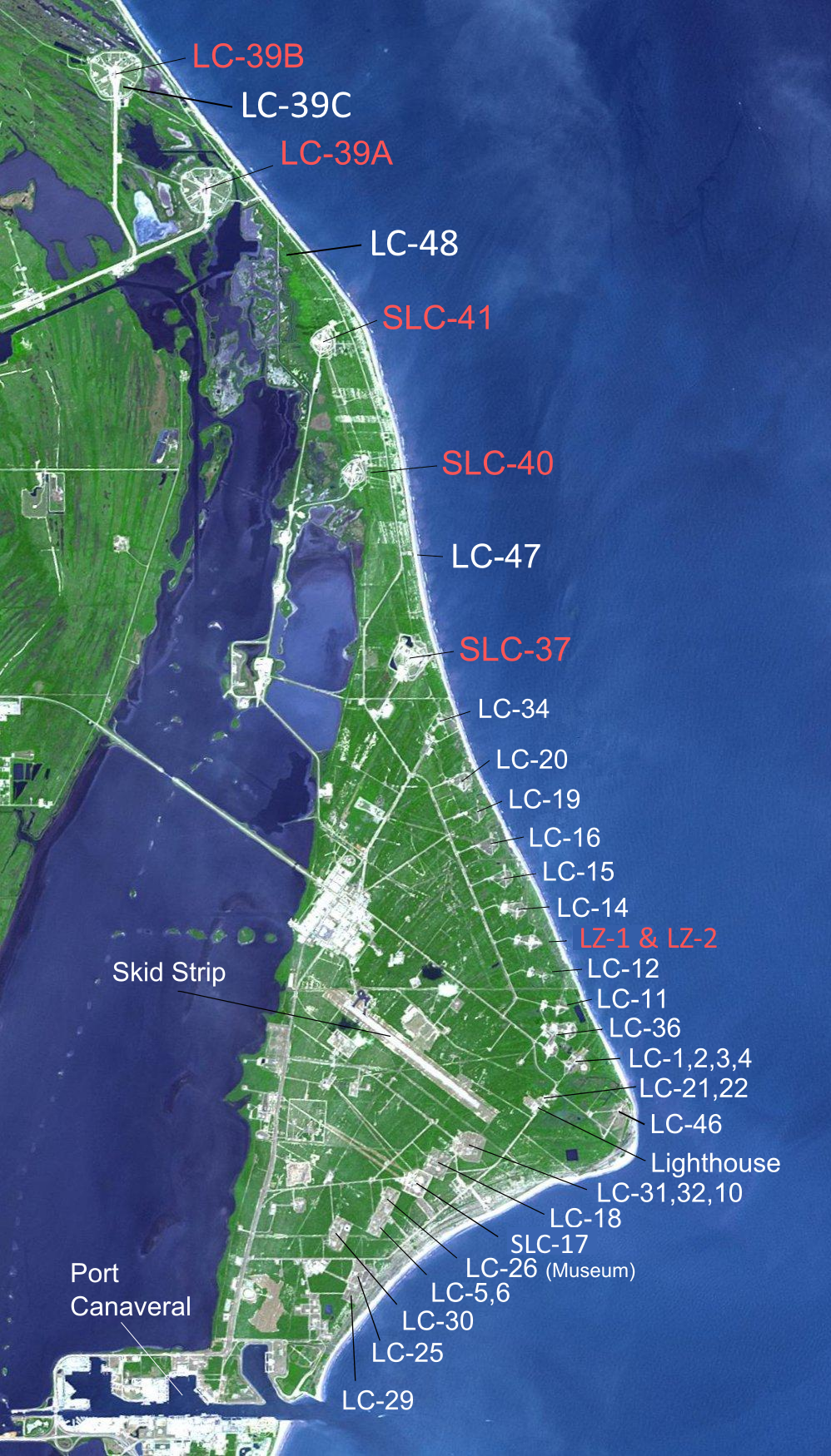
LC-13 and Landing Zone LZ-1 and LZ-2
LC-16
LC-36A
LC-36B
LC-37
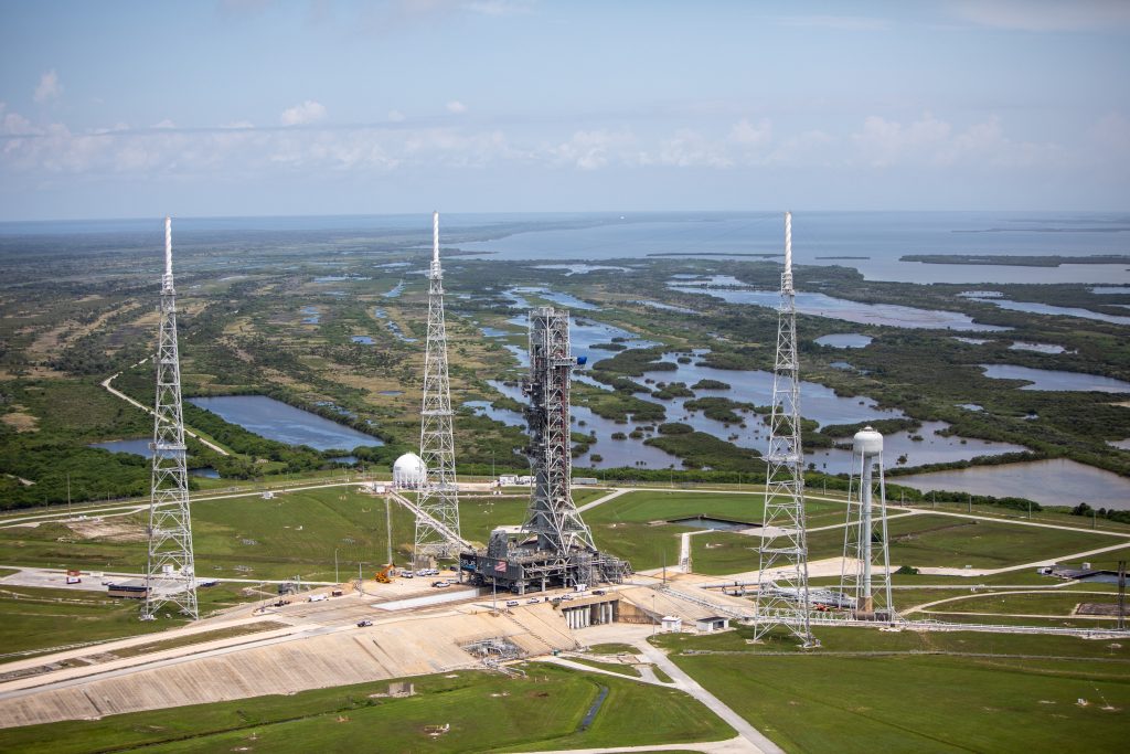
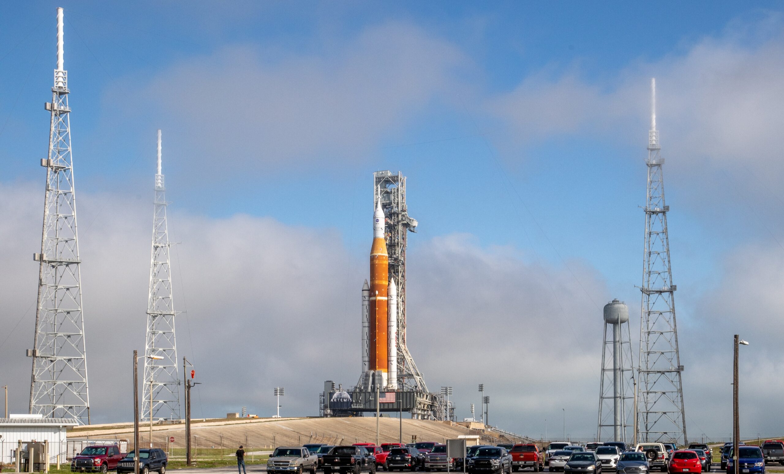
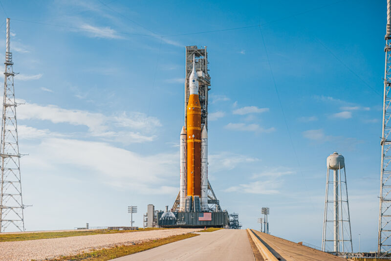
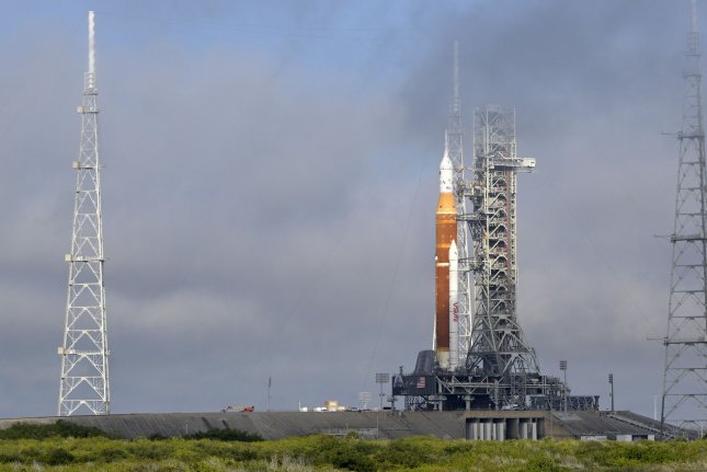
LC-39A
LC-39B
SLC-40
SLC-41
LC-46
VAB Area Turn Basin and Dock
Barge Canal
External Port Access – Port Canaveral
Footnote
Aerospace history Space dashboard Spaceflight milestones (1880-1961) 00-00-1880 Articles by Tsjolkowsky (1857-1935). 00-00-1923 Articles by Oberth (1894-1989). 16-03-1926 First liquid-fueled rocket by Goddard (1882-1945). Reached 13 meters. 00-00-1932 Gyroscopic rocket by Goddard (1882-1945). 00-00-1937 V1 and V2 by Wernher von…
Artemis II trajectory Artemis Dashboard Artemis II Trajectory Artemis II Trajectory https://www.youtube.com/shorts/e-0OIGVRWd8?feature=share Artemis II Trajectory Video Artemis II Piloting Demonstration Test Similar missions In 1968, the Apollo 8 mission, crewed by astronauts Frank Borman, Jim Lovell, and William Anders, was…
Astrobotic Technology Peregrine Missions Lunar lander. Commercial. ULA 08-01-2024 Launch Peregrine with first flight of a Vulcan Centaur (ULA). Kennedy Space Center (KSC). ULA is Boeing and Lockheed Martin). Peregrine Mission One 08-01-2024 Peregrine Lunar Lander (Astrobotic Technology). 08-01-2024 Launch…